
Personal Weather Station Networks: Where to Share Your Data
Compare public maps, manufacturer clouds, citizen-science feeds, and private options—then connect your station without compromising data quality or privacy.
Manufacturer cloud
Usually the simplest route for remote viewing, alerts, dashboards, and support.
Public PWS map
Share hyperlocal conditions with neighbors and compare nearby stations.
CWOP / MADIS
Contribute observations that can be quality-checked and distributed to weather users.
Choose the network by what you want to do
| Goal | Good starting point | What to confirm |
|---|---|---|
| See your station remotely | Your manufacturer’s cloud, such as Ambient Weather Network or Davis WeatherLink | Your console or gateway supports direct upload |
| Share on a public map | Weather Underground or PWSWeather | The service accepts your hardware or upload software |
| Contribute to a quality-controlled feed | CWOP, whose observations can flow through NOAA’s MADIS system | Accurate coordinates, elevation, siting, and reliable reporting |
| Keep observations private | A local dashboard, compatible home server, or privacy controls in your vendor service | Where data is stored and who can see it |
Common personal weather station networks
Ambient Weather Network
Designed around compatible Ambient Weather consoles and gateways, with web and app dashboards plus sharing controls. Official Ambient Weather network support →
Davis WeatherLink
The Davis ecosystem for live observations, charts, alerts, maps, and device-specific connectivity. Official WeatherLink site →
Weather Underground
A large public map of personal stations. Nearby stations can vary in siting and upkeep. Official PWS overview →
PWSWeather
A public station network and map that accepts uploads from supported station software and services. Official PWSWeather map and account tools →
CWOP and MADIS
CWOP lets volunteer observers contribute data that can flow into NOAA’s MADIS system. Location, exposure, uptime, and quality matter. Official NWS CWOP guidance →
Windy PWS
Windy provides station management and API-based uploads, with current instructions organized by device and software path. Official Windy PWS documentation →
WeatherFlow Tempest
Tempest owners can use the manufacturer dashboard and choose whether to make a station page public. Official Tempest sharing guidance →
More than one network
Some hardware or software can forward to multiple destinations. Confirm supported services, rate limits, privacy, and history retention before assuming every combination works.
How a station connects
A station may upload directly from its console, require a separate gateway, or rely on always-on software. Check the manual for your exact model. A brand name alone does not guarantee the same connection method across generations.
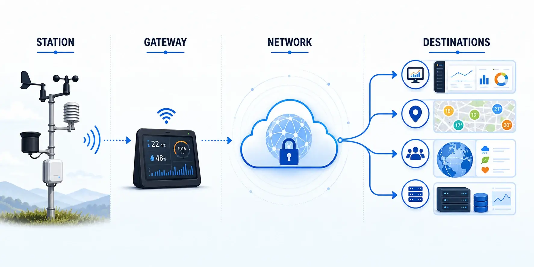
Setup checklist
- Install and validate the station first. Poor siting becomes public bad data. Use the installation guide and accuracy checks.
- Create the destination account. Use the network’s official onboarding path and record the station ID/key privately.
- Enter precise metadata. Coordinates, elevation, time zone, sensor height, and station type help others interpret the readings.
- Connect the console, gateway, or software. Never paste private upload keys into public posts or screenshots.
- Confirm the first observations. Check units, timestamps, wind direction, rainfall totals, and gaps.
- Monitor the data quality. Compare with nearby trusted stations and maintain the sensors on schedule.
Quality, privacy, and sharing to more than one network
Verify the whole connection path
A station name alone is not enough. Confirm the exact outdoor array, console or gateway, firmware, upload method, and destination. Some systems upload directly. Others need manufacturer relay, a computer, compatible software, or an additional gateway. Recheck official documentation before buying hardware because supported services can change.
Make the observation interpretable
Enter coordinates, ground elevation, time zone, units, pressure type, and station model carefully. Document sensor height, surface, major obstructions, and maintenance. A plausible value with the wrong timestamp, elevation, or location can be more misleading than an obvious error.
Review what becomes public
Public maps may show a station name, approximate or exact coordinates, photos, profile details, and observation history. Use the service’s privacy controls where available, avoid embedding private credentials in screenshots, and choose a station name that does not disclose more than intended.
Can one station upload to several networks?
Often yes, but only when the station, gateway, software, or manufacturer cloud supports each destination. Establish one reliable path first. Then add another destination and compare timestamps, units, rain totals, pressure interpretation, and missing-data behavior for several days. Different networks may store, filter, suppress, or redistribute observations differently, so identical source data can appear differently on two public pages.
Keep a simple record of station IDs, destinations, update intervals, and where each credential is stored. Never publish passwords, API keys, station keys, or tokens. If one service stops updating while another continues, trace the path from sensor to console, local network, uploader, and destination rather than resetting every component at once. The weather-data upload guide provides a step-by-step setup and verification sequence.
Plan for service changes. Keep a local export or another independent record when history matters to you. Network ownership, account requirements, APIs, retention periods, and supported upload methods can change. Review the destination’s current documentation periodically and test recovery before replacing a console, router, gateway, or station ID.
If data is not appearing
Nothing uploads
Confirm internet access, station ID/key, destination selection, and the model’s supported upload method.
Data is delayed
Check console-to-gateway reception, upload interval, account status, and service notices before repeatedly resetting equipment.
Readings look wrong
Verify units, elevation, time zone, sensor siting, and calibration. Network software cannot repair a bad exposure.
One network works, another does not
Each destination has its own credentials and supported fields. Recheck that destination rather than changing the working one.
Frequently asked questions
Do I need to share publicly?
The answer is no. Remote access and public sharing are separate choices on many platforms.
Can I upload to several networks?
Often, but only when your console, gateway, or software supports each destination. Avoid unsupported workarounds that expose credentials.
Does joining a network make my readings accurate?
The answer is no. Accuracy still depends on sensor quality, placement, calibration, maintenance, and quality control.
What should I do before joining CWOP?
Verify location metadata, stable reporting, and good siting. Read the current official CWOP guidance before registering.
Primary references: NOAA/NWS Citizen Weather Observer Program and MADIS guidance, official Ambient Weather Network, Davis WeatherLink, Weather Underground, and PWSWeather service documentation. Service features and compatibility can change—confirm with the current documentation for your exact hardware.
Sources and further reading
These official and manufacturer references document the major personal weather-station networks and their data-sharing options.
Ambient Weather Network support — Manufacturer guidance for connecting compatible stations to its network.
Davis WeatherLink — Manufacturer platform for storing and sharing Davis station observations.
Weather Underground PWS overview — Network documentation for adding a personal station.
NWS Citizen Weather Observer Program — Official overview of sharing observations through CWOP.