
Weather observation field guide
What Is a Mesonet Weather Station?
A mesonet is a regional network of closely spaced, frequently reporting stations built to observe weather variations that broader national networks may miss.
Quick answer A mesonet is a coordinated regional network of automated weather stations with higher spatial density and reporting frequency than a broad national network. Stations commonly measure temperature, humidity, wind, pressure, and precipitation. Some add soil, solar, road, hydrologic, or agricultural sensors. A mesonet is the network, not a single sensor type.
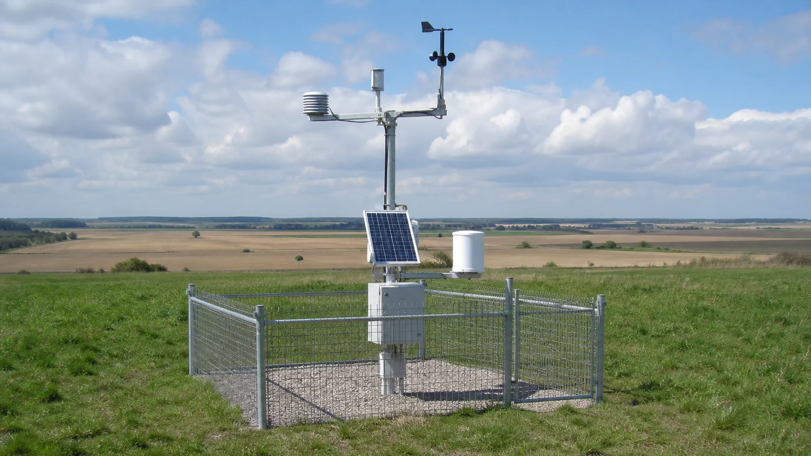
What makes a network a mesonet?
The word combines mesoscale and network. Mesoscale weather includes phenomena smaller than broad synoptic weather systems but larger than a single backyard, such as thunderstorm outflows, lake breezes, urban heat patterns, mountain-valley winds, and localized rainfall.There is no single universal hardware package. The defining idea is coordinated observations dense and frequent enough for a regional mission. State universities, departments of transportation, agriculture programs, emergency managers, utilities, and private operators all run mesonets.What mesonet stations measure
| Variable | Common use | Important caution |
|---|---|---|
| Temperature and humidity | Heat, cold, dew point, crop and fire conditions | Radiation shielding and surface exposure matter |
| Wind | Storm outflow, fire weather, transport, spraying | Tower height and nearby obstacles change readings |
| Precipitation | Flood, drought, agriculture, storm totals | Wind, snow, clogging, and gauge type affect catch |
| Soil and solar | Agriculture, irrigation, energy, drought | Depth, calibration, and maintenance must be known |
| Road or hydrologic data | Transportation and flood operations | Not every network exposes every variable publicly |
Mesonet vs. ASOS, COOP, and personal stations
ASOS and AWOS stations primarily support aviation and official surface observations. NWS Cooperative Observer Program stations emphasize consistent daily climate observations, often by trained volunteers. Personal weather stations are privately installed and can fill neighborhood gaps, but equipment, siting, and maintenance vary.A mesonet can include government, university, transportation, agricultural, or private stations. NOAA's Integrated Mesonet in MADIS combines observations from many providers, converts them to common formats and units, and attaches quality-control information. Inclusion does not make every reading interchangeable. Provider, siting, instrument height, and quality flags still matter.How to find a mesonet station near you
- Search the state or regional name plus “mesonet.” Many networks are operated by a state climatologist or university.
- Open the station metadata. Confirm coordinates, elevation, observation time, sensor height, and provider.
- Check the observation time. A familiar map marker can show stale data if communications failed.
- Compare nearby stations. Look for terrain and exposure reasons before calling one value wrong.
- Choose the network for the question. Airport observations, climate records, road sensors, and backyard stations serve different purposes.
Read the station metadata before using the number
A map marker can make every station look equivalent, but the metadata determines what the observation means. First confirm the station identifier and coordinates, similarly named sites may be miles apart or may have moved. Then check elevation, land cover, sensor height, exposure, reporting interval, and the time zone used by the display or download. These details are especially important when comparing wind, temperature, rainfall, soil moisture, or daily extremes.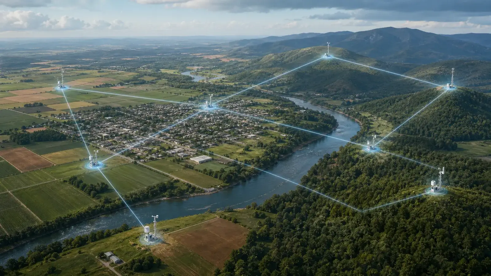
| Metadata field | Question it answers | Why it changes interpretation |
|---|---|---|
| Timestamp and interval | Is this an instantaneous, averaged, accumulated, or daily value? | A five-minute wind peak cannot be compared directly with an hourly average |
| Sensor height and exposure | Where and how is the instrument mounted? | Wind near a roof or temperature over pavement can differ from open-field exposure |
| Gauge and accumulation period | What device measured precipitation and when did the total reset? | Storm, hourly, and calendar-day totals answer different questions |
| Quality flag | Did an automated or human check mark the value? | A flagged value may still appear on a map but should not be used without review |
| Maintenance history | Was equipment changed, calibrated, obstructed, or offline? | A step change may reflect the station rather than the weather |
How to judge a mesonet observation
- Is the timestamp current and the reporting interval clear?
- Does the station page identify the provider and station elevation?
- Are instrument height and siting documented?
- Are quality-control flags or maintenance notes available?
- Does the value agree with nearby stations after accounting for terrain and land cover?
Quality control is not the same as certification. Automated checks can catch impossible values, sudden jumps, and disagreement with neighbors, but they cannot see every local obstruction, coating, maintenance issue, or slow sensor drift.