
Storm-spotting field guide
Scud Cloud vs. Funnel Cloud: How to Tell the Difference
Ragged scud can look alarming, but a funnel is tied to organized rotation. Shape alone is not enough—and debris at the ground changes the diagnosis immediately.
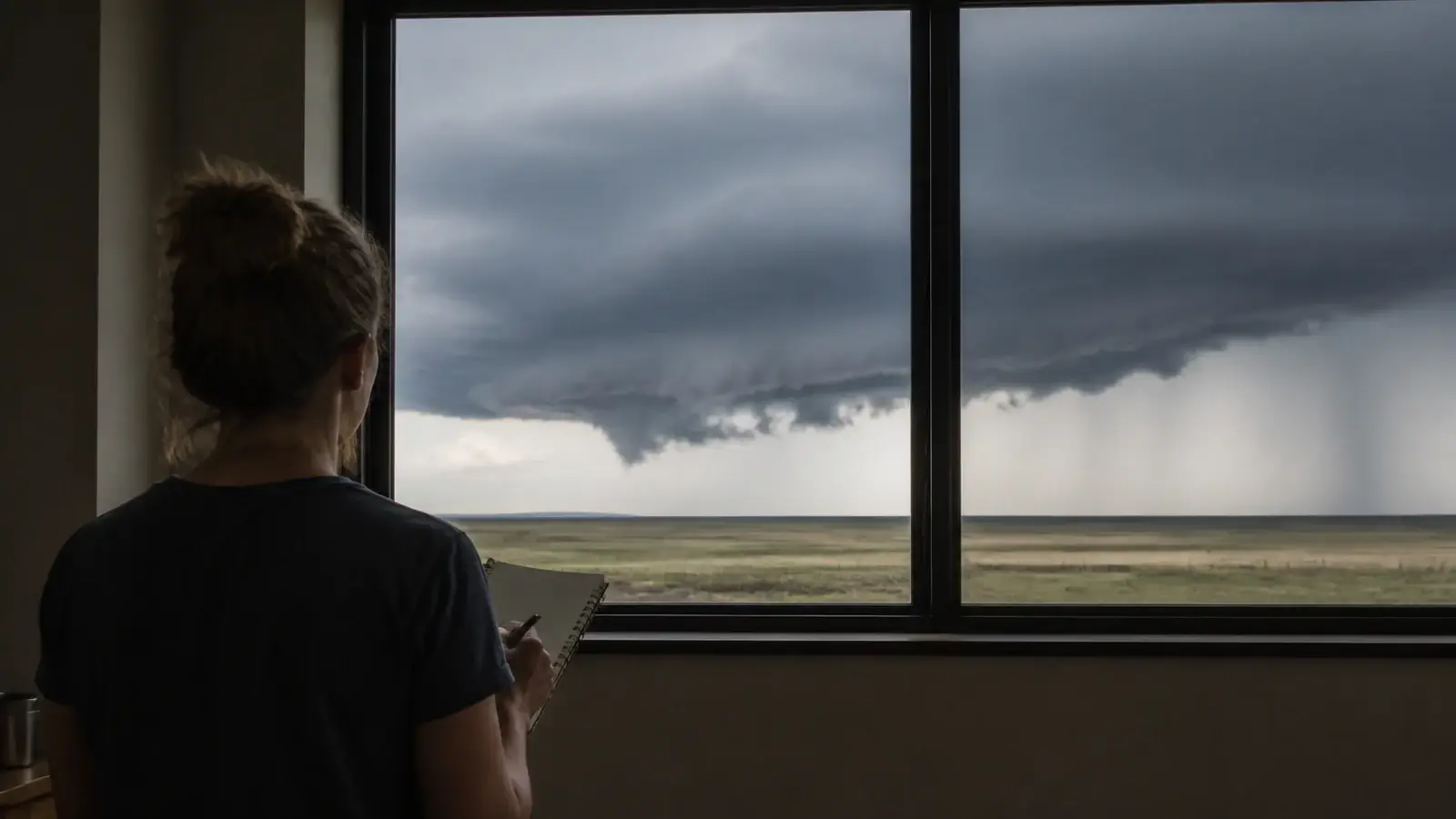
Quick answer
Scud is a ragged, low cloud fragment that may rise, sink, or move rapidly near a storm but lacks persistent organized rotation. A funnel cloud is attached to a convective cloud base and associated with a rotating column of air. Watch the feature for coordinated rotation, not merely sideways motion or changing shape. If rotation is present or dust and debris are moving at the ground, take shelter and treat the situation as dangerous.
A low, pointed cloud beneath a thunderstorm can trigger an immediate tornado photo online. Sometimes that concern is justified. Often the feature is scud—a turbulent fragment condensing in moist air near rain or storm inflow. Distinguishing the two is one of the most common challenges for new weather spotters because a single snapshot hides the most important evidence: motion.
This guide can improve what you look for, but it cannot make a distant or rain-wrapped feature safe to study. If a warning is issued, a feature appears to rotate, or debris is rising at ground level, move to shelter instead of waiting for visual certainty.
What is a scud cloud?
Scud is the common spotter term for small, ragged clouds beneath a larger cloud deck. Meteorologists may call these fragments pannus. They form when humid air cools to saturation in the uneven flow around precipitation, outflow boundaries, or the inflow region of a storm. Their bases and edges are usually irregular, torn, and constantly changing.
Scud can appear to rise rapidly toward the storm base as moist inflow lifts and condenses. It can also race sideways with wind, sink beneath rain, or merge into a larger lowering. That rapid movement looks dramatic, but translation is not rotation. A car moving down a road changes position. A wheel turns around an axis. Spotters are looking for the cloud equivalent of the turning wheel.
Scud itself is not a tornado and does not automatically mean a tornado is forming. It can occur with ordinary showers, along gust fronts, or beneath severe storms. Its presence does confirm strong moisture contrasts and turbulent motion, so the surrounding weather—not the nickname—determines the hazard.
What is a funnel cloud?
The National Weather Service defines a funnel cloud as a condensation funnel associated with a rotating column of air that does not reach the ground. It generally extends downward from the base of a convective cloud. The visible funnel forms where pressure and temperature changes cause water vapor to condense within part of the circulation.
A funnel may be tapered, rope-like, broad, or partly hidden. It does not need to be perfectly smooth, and it may appear and disappear as humidity changes even while the circulation continues. Conversely, a smooth pointed lowering is not automatically a funnel. The defining characteristic is organized rotation connected to a rotating column, not its resemblance to a cone.
Some funnels are associated with rotating supercell thunderstorms and can become strong tornadoes. Others are brief, weak, or connected to non-supercell processes. From a public-safety perspective, any credible funnel deserves prompt attention because the ground circulation can develop before an observer sees a complete condensation tube.
How to tell scud from a funnel cloud
| Clue | Scud cloud | Funnel cloud |
|---|---|---|
| Connection | May be detached, beneath rain, or merging unevenly into a lowering | Usually extends from or is clearly associated with a convective cloud base |
| Shape | Ragged, fragmented, and rapidly changing, can briefly look pointed | Often tapered or tubular, but may be ragged or partly hidden |
| Motion | Rises, sinks, or translates with the wind without a common rotating axis | Shows persistent, organized rotation around a shared vertical or tilted axis |
| Duration | Fragments may form and dissipate quickly in different places | Rotation tends to remain coordinated even if condensation changes |
| Ground signs | No rotating debris circulation tied to the feature | Dust or debris circulation beneath it indicates a tornado may be present |
When no warning or immediate threat requires shelter, observe long enough to establish persistent motion instead of relying on one glance or photograph. Pick identifiable edges or tags and see whether multiple parts move around the same center. A lowering drifting left across your view is not enough. One edge consistently moving toward you while the opposite edge moves away can support rotation, though perspective and vehicle motion can be misleading.
Next, relate the feature to storm structure. A rain-cooled gust front often carries ragged scud and shelf-cloud fragments. A persistent lowering beneath the rain-free base in a storm's inflow region deserves closer concern, especially if the broader base is rotating. Spotter training teaches these relationships because zoomed-in shape recognition alone produces many false reports.
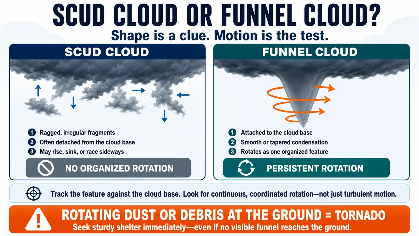
Do not wait for a textbook funnel. Rain can obscure the circulation, darkness can remove contrast, and a tornado may have little visible condensation. Warnings, a roaring sound, power flashes, and rotating dust or debris are reasons to act immediately.
A funnel cloud does not need to “touch down” visibly
The phrase “the funnel has not touched the ground” can create false reassurance. A tornado is a violently rotating column of air in contact with the ground and extending from a thunderstorm. The condensation funnel only reveals the portion of that circulation where moisture condensed. It may stop well above the surface while damaging winds and a debris cloud already exist below.
If dust, leaves, or debris are rotating at the ground beneath a funnel or rotating cloud base, report a tornado and seek shelter. Do not require a continuous white or gray tube from cloud to ground. Likewise, a low dust plume without a clear connection to a thunderstorm could have another cause, so include the context and exact observed motion rather than simply labeling every dust swirl a tornado.
A wall cloud is another term that can be confused with both. It is a localized, persistent lowering beneath the rain-free base of a thunderstorm, often on the storm's inflow side. A wall cloud can rotate and produce a funnel, but not every wall cloud rotates and not every rotating wall cloud produces a tornado. Scud may be drawn into it, making the edges look especially turbulent. Our shelf cloud versus wall cloud guide explains how storm position, airflow, and motion distinguish a wall cloud from a gust-front shelf.
How to observe a suspicious lowering safely
- Check warnings first. Use Wireless Emergency Alerts, NOAA Weather Radio, or your local National Weather Service page. If warned, shelter rather than continuing the diagnosis.
- Stay in a sturdy location. Do not stand in an open field or beneath a garage door to improve the view. Keep a short route to an interior lowest-floor room.
- Watch the whole base. Avoid zooming so tightly that you lose the feature's relationship to rain, inflow, and surrounding cloud motion.
- Look for coordinated rotation. Track two or more reference points around a common center for persistent motion.
- Check the ground only from safety. A debris cloud, rotating dust, or converging power flashes can reveal a tornado when the cloud is obscured.
Nighttime spotting is much harder. Do not repeatedly use a camera flash or drive toward a storm. Lightning may briefly outline a feature, but it also creates extreme contrast and misleading shapes. In darkness, rely more heavily on warnings, radar-informed official messaging, trained reports, and safe shelter decisions.
How to report what you see
If you see persistent rotation, a funnel, or rotating debris, contact the National Weather Service using your local office's published reporting channels. State the exact time and location, your viewing direction, the feature's motion, whether it is attached to the cloud base, and whether debris is present at the ground. “Rotating funnel halfway to the ground, no debris visible, looking northwest from Main and 4th at 6:42 p.m.” is more useful than “possible tornado.”
If uncertain, say exactly that and describe the evidence: “Ragged lowering moving rapidly north, I cannot confirm rotation.” Meteorologists would rather receive an honest description than an overconfident label. Photos or short video can help later, but do not delay the initial report or expose yourself to obtain them.
Formal SKYWARN instruction includes local storm climatology, reporting criteria, radar context, and more visual examples than any article can provide. If you want to contribute regularly, see how to become a trained weather spotter.
Take shelter now if
- A tornado warning includes your location.
- You see persistent organized rotation beneath the storm.
- Dust or debris rotates at the ground under a lowering.
- A nearby tornado is reported and the storm is moving toward you.
- You cannot safely determine what a rain-wrapped or nighttime feature is.
Frequently asked questions
Can a scud cloud rotate?
Turbulent fragments can twist or change shape briefly, and scud can be drawn into a rotating storm base. The concern rises when multiple features show persistent, organized rotation around a common axis rather than random eddies.
Does every funnel cloud become a tornado?
The answer is no. Many funnels dissipate without a confirmed ground circulation. Because a tornado can form quickly and the condensation may be incomplete, any credible funnel should be treated seriously.
Can there be a tornado without a visible funnel?
The answer is yes. The rotating column can reach the ground while the condensation funnel remains aloft or is hidden by rain. Rotating dust or debris at the surface is a critical clue.
Is a wall cloud the same as scud?
The answer is no. A wall cloud is a persistent lowering connected to a thunderstorm base, usually in the inflow area. Ragged scud fragments may form nearby or be drawn into it, which can make identification harder.
Sources and further reading
- National Weather Service glossary: Funnel cloud
- National Weather Service Norman: Storm spotter glossary
- National Weather Service Norman: Introduction to storm spotting
- National Weather Service Wilmington: SKYWARN spotter guide
Reviewed against current National Weather Service, NOAA, and volunteer-observer guidance on August 7, 2026.