
Weather radar explained
Why Radar Shows Rain When It Isn’t Raining
Radar samples the atmosphere above you, not a rain gauge at your door. Virga, beam height, drift, clutter, and app processing can all separate the map from the ground.
Quick answer
Weather radar looks outward and upward, so its lowest beam may sample rain or snow thousands of feet above the ground. That precipitation can evaporate in dry air as virga, drift away before landing, or miss your address within a radar pixel. Ground clutter, insects, birds, and app processing can also color the map. Check the loop, timestamp, nearby surface observations, and the sky before deciding the radar is wrong.
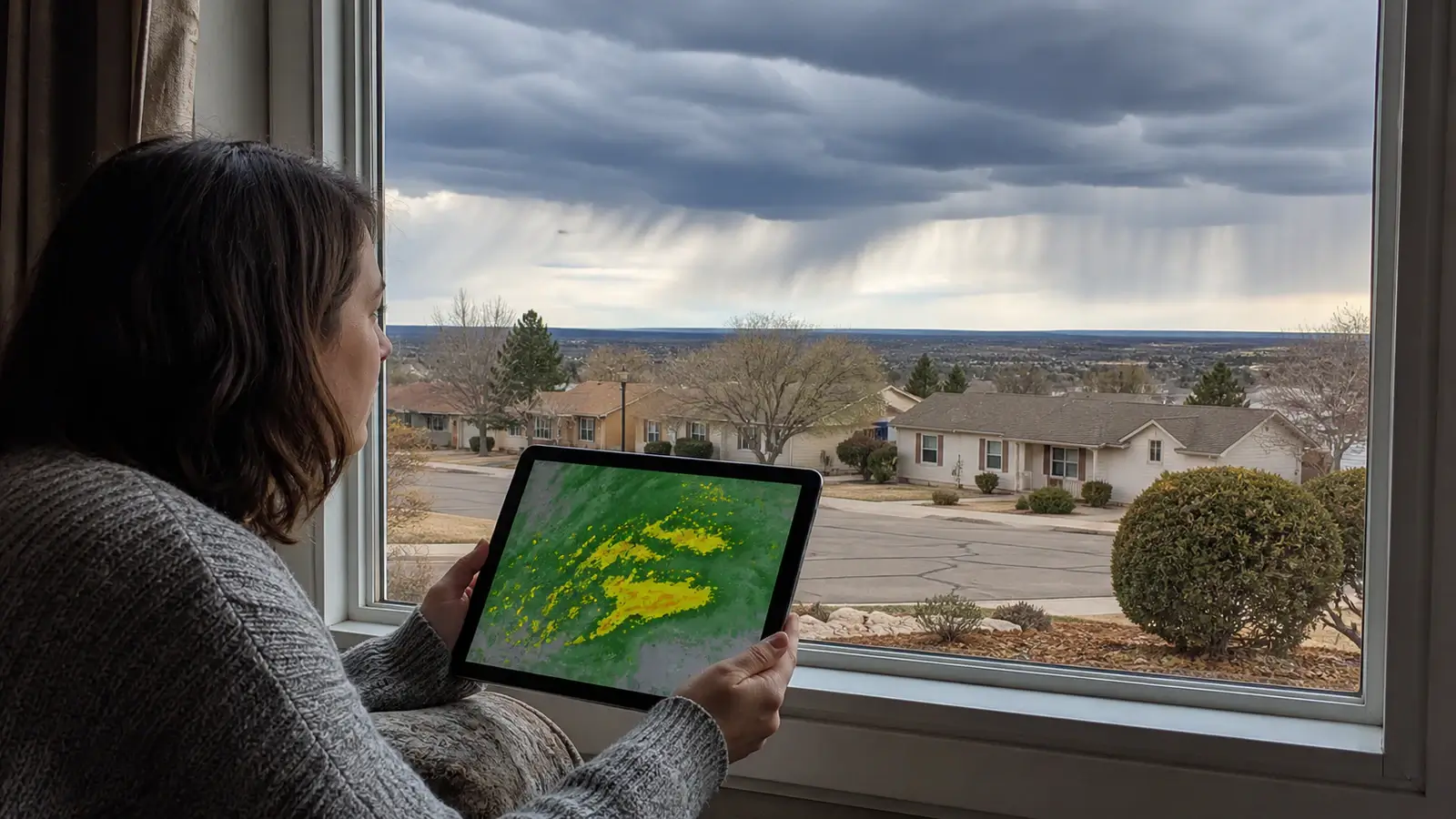
You open a weather app, see green or yellow over your neighborhood, and look outside to find a dry driveway. The natural reaction is that the map failed. Sometimes it did display a non-weather return, but often the radar accurately detected precipitation that never reached the surface where you stood.
The apparent contradiction disappears once you separate two observations: radar samples a volume of the atmosphere, while you observe one point at ground level. They are related, not identical.
What weather radar actually sees
Doppler radar sends short pulses of microwave energy and listens for a small portion reflected by objects in the beam. Raindrops, snowflakes, hailstones, insects, birds, and ground objects can all return energy. Reflectivity products estimate the strength of those returns and display them with colors. Our guide to radar reflectivity versus velocity explains which layer shows echo strength and which shows motion. The colors are not a camera image of rain touching the road.
A radar completes scans at several elevation angles, and apps usually combine or select products before drawing them on a familiar flat map. One colored pixel may summarize a broad three-dimensional sample. Its exact footprint changes with distance, beam width, terrain, and the product being viewed.
Reflectivity is related to particle number and size, but converting it to a surface rainfall rate requires assumptions. Melting snow, hail, and large drops can produce strong echoes that do not translate cleanly into the amount a gauge collects. Radar is exceptionally useful because it shows storm structure and motion across a large area. It is not a replacement for every ground observation.
The most common explanation: virga
Virga is precipitation falling from a cloud that evaporates or sublimates before reaching the ground. It often appears as gray streaks extending below a cloud base and fading into drier air. Radar can detect the drops or ice crystals high in the streak while a person beneath them feels nothing.
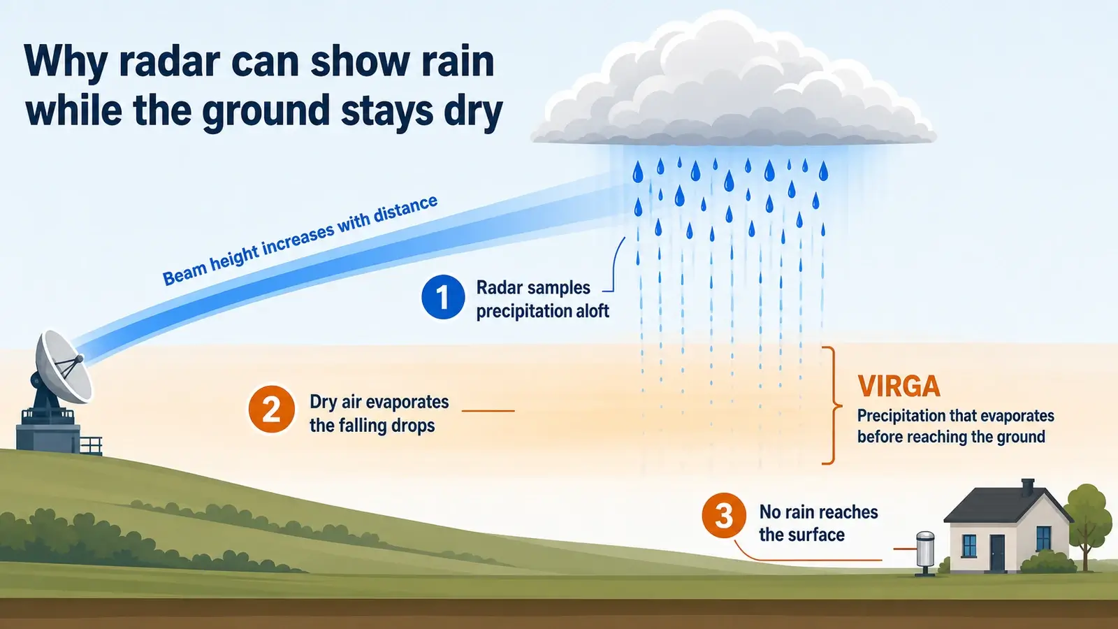
Evaporation becomes more effective when the air below the cloud is dry. Falling drops consume heat as they evaporate, cooling and moistening that layer. If precipitation continues long enough, the air may approach saturation and rain can eventually reach the ground. That is why a radar-filled sky can remain dry for a while and then suddenly begin raining without the echo changing dramatically.
In cold air, falling ice crystals can sublimate directly into water vapor. The surface result is the same: radar detected a real hydrometeor aloft, but the measurable precipitation at the ground is zero. Virga can also contribute to gusty downdrafts because the cooled air becomes denser and sinks.
The radar beam may be far above you
Radar beams rise above the surface because the antenna points slightly upward and the Earth curves away beneath the path. Atmospheric refraction bends the beam somewhat, but it still samples progressively higher altitudes with distance. By roughly 100 miles from a radar, even the lowest scan may be sampling several thousand feet above the ground, and the widening beam represents a deep layer rather than one exact altitude.
At that height the radar can see snow, rain, or melting precipitation inside a cloud while the lowest several thousand feet remain dry. The beam also widens with distance, so the displayed return represents a larger vertical and horizontal volume. This is one reason rural locations far from a radar may experience a larger difference between the image and the surface.
Terrain complicates the picture. Mountains or buildings can block part of the beam, while bending under unusual temperature and moisture profiles can send energy toward the ground. A national mosaic blends data from multiple radars to reduce gaps, but the finished image still carries the limitations of each scan.
Other reasons the app can look wet
Precipitation drifts while it falls
Wind at cloud level can carry drops or snowflakes sideways. The radar plots where the particles were sampled aloft, but they may reach the surface several miles downwind. In strong vertical wind shear, the echo and the rain shaft can be visibly tilted. A sharp-edged summer shower can also cover most of a map pixel while missing one block.
Ground clutter and anomalous propagation
Buildings, hills, wind turbines, and other fixed objects sometimes return energy. Under certain temperature inversions, the beam bends more strongly than usual and strikes the ground farther from the antenna, producing anomalous propagation. Quality-control algorithms remove much of this clutter, but not all of it. Clutter often remains stationary while real precipitation moves and evolves.
Biological targets and airborne material
Bird migrations, bats leaving roosts, dense insect layers, wildfire debris, and military chaff can be visible to radar. Dual-polarization products help meteorologists classify target shapes and orientations, but a simplified consumer app may show only a familiar rain-like color scale.
An expanding ring near sunrise is one useful biological clue. Our radar rings guide compares it with melting-layer rings and display artifacts.
A thin line moving away from thunderstorms may be an outflow boundary, with small targets concentrated along its leading edge. Our radar fine lines guide shows a documented example and explains why the boundary can bring a wind shift before any rain.
App timing, smoothing, and mosaics
A radar image has an acquisition time, processing time, and delivery delay. An app may smooth blocky pixels, extrapolate motion, or label a forecast layer “future radar.” The precipitation may already have ended, or the layer may be a model projection rather than the latest observation. Always check the timestamp and product label.
| Pattern on the loop | Possible explanation | Useful check |
|---|---|---|
| Echo moves with clouds but ground stays dry | Virga or beam sampling aloft | Look for streaks below clouds and check nearby surface reports |
| Patch stays fixed scan after scan | Ground clutter or terrain return | Compare with clear-weather radar from another day |
| Ring or expanding burst near sunset | Birds, bats, or insects | Check radar discussion and whether the return follows roost locations |
| Rain begins downwind of the colored area | Falling precipitation drifted | Compare cloud-level and surface wind direction |
| Map says “future” or animation extends ahead of now | Short-term app projection | Return to the latest observed radar frame |
How to tell what is happening at your location
- Confirm the layer and timestamp. Select observed radar reflectivity rather than a future simulation, and note how old the final frame is.
- Play the loop. Real precipitation generally moves, grows, weakens, or changes shape. A persistent fixed patch suggests clutter, although slow-moving weather is possible.
- Look outside safely. Virga may hang as streaks below a cloud. During thunderstorms, stay inside and observe away from windows rather than stepping out for a better view.
- Check surface observations. Nearby airport reports, personal stations, mesonets, and gauges can show where precipitation is actually reaching the ground.
- Use the official forecast and warnings. A dry doorstep does not mean the storm is harmless or that later cells will also evaporate.
A large temperature–dew point spread near the surface supports the possibility of dry sub-cloud air, but it is not a stand-alone virga detector. Humidity varies with height, and a single station may sit outside the falling shaft. Combine several clues rather than relying on one app number.
Why rain can fall when radar looks clear
The mismatch works in the other direction too. Very light drizzle may consist of droplets too small or shallow for a distant beam to detect well. Low precipitation can occur beneath the beam, especially far from the radar. Terrain blockage can hide part of a storm, and an app may be showing an older frame or filtering weak echoes.
Your gauge is therefore the best answer to “how much fell here,” provided it is exposed and read correctly. Radar is the better tool for “where is precipitation across the region, how is the storm organized, and where is it moving?” Our home rainfall guide explains how to collect that surface truth.
Never use an apparent radar gap to ignore thunder or a warning. Lightning can strike outside the visible rain area, and severe wind or hail can reach the ground from a storm whose lowest radar sample is far above you. Radar interpretation should refine situational awareness, not replace basic safety rules.
Frequently asked questions
Can radar detect rain that evaporates before reaching the ground?
The answer is yes. Radar can detect drops or ice crystals aloft even when they evaporate or sublimate in a dry layer below. This is called virga.
Why does the mismatch happen more often far from a radar?
The lowest beam rises and broadens with distance, so it samples a higher and larger volume of the atmosphere rather than conditions close to the surface.
How can I tell clutter from real rain?
Animate several scans. Fixed returns near terrain or the radar favor clutter, while precipitation usually moves and changes. Surface observations and National Weather Service radar discussions add context.
Is future radar an actual radar observation?
The answer is no. Future radar is generally a short-term projection or model output based on recent conditions. Check the label and return to the latest observed frame when confirming what exists now.
Sources and further reading
- National Weather Service Louisville: Virga explained graphically
- National Weather Service: Basics of weather radar (PDF)
- National Weather Service Birmingham: Radar beam limitations
- National Weather Service Arkansas-Red Basin: Radar precipitation errors
Reviewed against current National Weather Service, NOAA, and volunteer-observer guidance on August 7, 2026.