
Cloud identification guide
Do Mammatus Clouds Mean a Tornado Is Coming?
Mammatus are pouch-like features beneath a cloud, often a thunderstorm anvil. They can accompany powerful storms, but the pouches themselves do not predict a tornado and may be most visible after the main hazard has moved away.
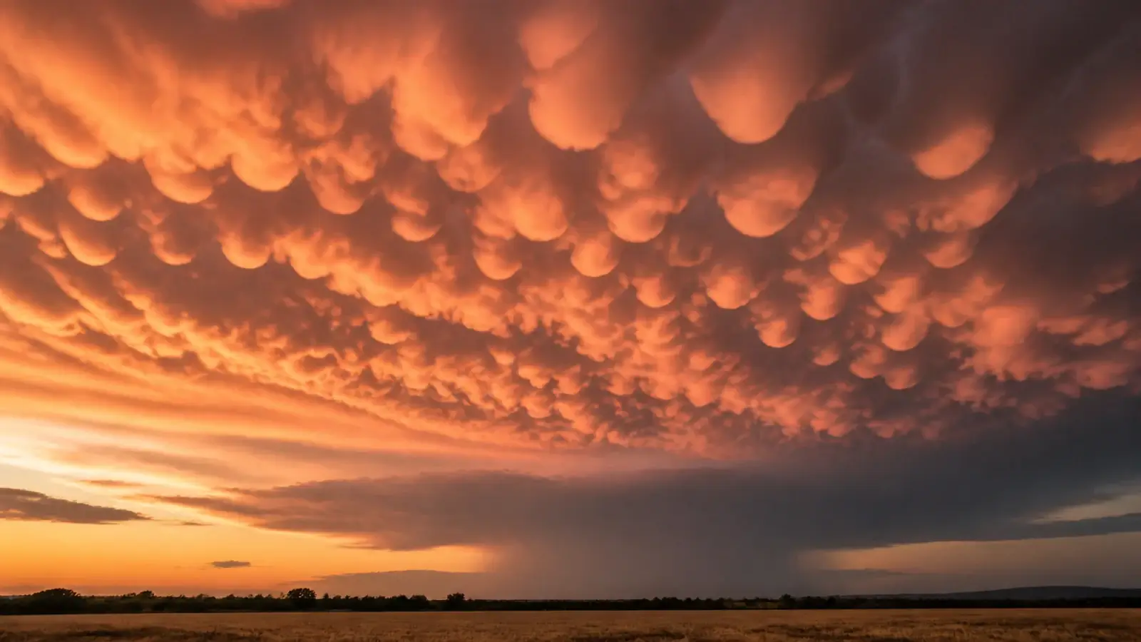
Quick answer
The answer is no. Mammatus clouds do not mean a tornado is coming. They are rounded pouches on the underside of a cloud, most famously a cumulonimbus anvil. Their presence tells you that complex motions and moisture exist in or beneath the parent cloud, and that a strong thunderstorm may be or may have been nearby. Mammatus can occur with severe, non-severe, or already departing storms and under other cloud types. Use official warnings, radar, and ground-level storm features—not mammatus alone—to judge tornado risk.
Few clouds look more dramatic than a ceiling of smooth pouches glowing orange after a storm. Their unusual downward shape invites a simple explanation, and social posts often supply one: tornadoes are imminent. That claim confuses association with prediction. Mammatus frequently occur on thunderstorm anvils, and some of those storms are severe, but the pouches are not a tornado precursor.
A better observation separates the remote anvil from the dangerous part of the storm. Mammatus may spread far from the updraft and remain visible after rain, hail, or damaging wind has passed. The local sky can be calm while the parent thunderstorm is still hazardous somewhere else.
What mammatus clouds are
Mammatus describes a supplementary cloud feature: rounded, pouch-like protrusions hanging from a cloud’s underside. The name comes from the Latin word mamma, referring to a breast or udder. Individual pouches may be smooth or ragged, organized into a field, and illuminated strongly near sunrise or sunset.
They are most familiar beneath the spreading anvil of a cumulonimbus thunderstorm, where ice-rich cloud extends far downwind from the updraft. Mammatus can also occur with altocumulus, altostratus, stratocumulus, and other clouds, and similar pouch structures have been observed beneath volcanic ash clouds. They are a shape category, not a storm classification.
A mammatus field may cover a broad area and last from minutes to longer periods as the anvil evolves. Perspective makes nearby pouches look larger, while low-angle sunlight emphasizes their texture. The feature is visible because cloud-filled descending lobes and clearer surrounding areas create a lumpy boundary.
How the pouches form
Mammatus formation is an active fluid-dynamics problem rather than one settled one-sentence process. Proposed mechanisms involve negatively buoyant cloudy air descending beneath an anvil, evaporation or sublimation cooling, hydrometeor fallout, melting, radiative effects, turbulence, and instability along the cloud boundary. More than one process may operate in the same storm.
The common statement that mammatus are “clouds made by sinking air” is directionally useful but incomplete. Cloud can persist in descending lobes when microphysical cooling and moisture offset the warming that ordinarily occurs as air sinks. Surrounding clear air may rise between the pouches, sharpening the cellular pattern.
Because mammatus usually hang beneath a high anvil, their airflow is not the same as the low-level rotation that produces a tornado. A pouch does not lengthen downward into a funnel. Mammatus and tornadoes can coexist beneath the same broad storm system while arising in very different regions and processes.
What mammatus say about severe weather
A large, ice-rich anvil indicates a deep thunderstorm, and deep thunderstorms can produce lightning, hail, strong wind, heavy rain, and tornadoes. Mammatus therefore provide context that substantial convection is or was nearby. They do not tell you which hazard is occurring at your location, how strong it is, or which direction it is moving.
The pouches are often easiest to see on the trailing or spreading anvil after the storm core has moved away and sunlight reaches the underside. “Often after the worst has passed” is an observation pattern, not an all-clear rule. Another storm may be approaching, lightning can persist, and the parent storm may still be severe downstream.
Mammatus also occur with non-tornadic storms. Their presence has no operational tornado-warning threshold. Meteorologists issue tornado warnings from radar-indicated rotation, reliable reports, observed tornadoes, and the full storm environment—not from the appearance of anvil pouches.
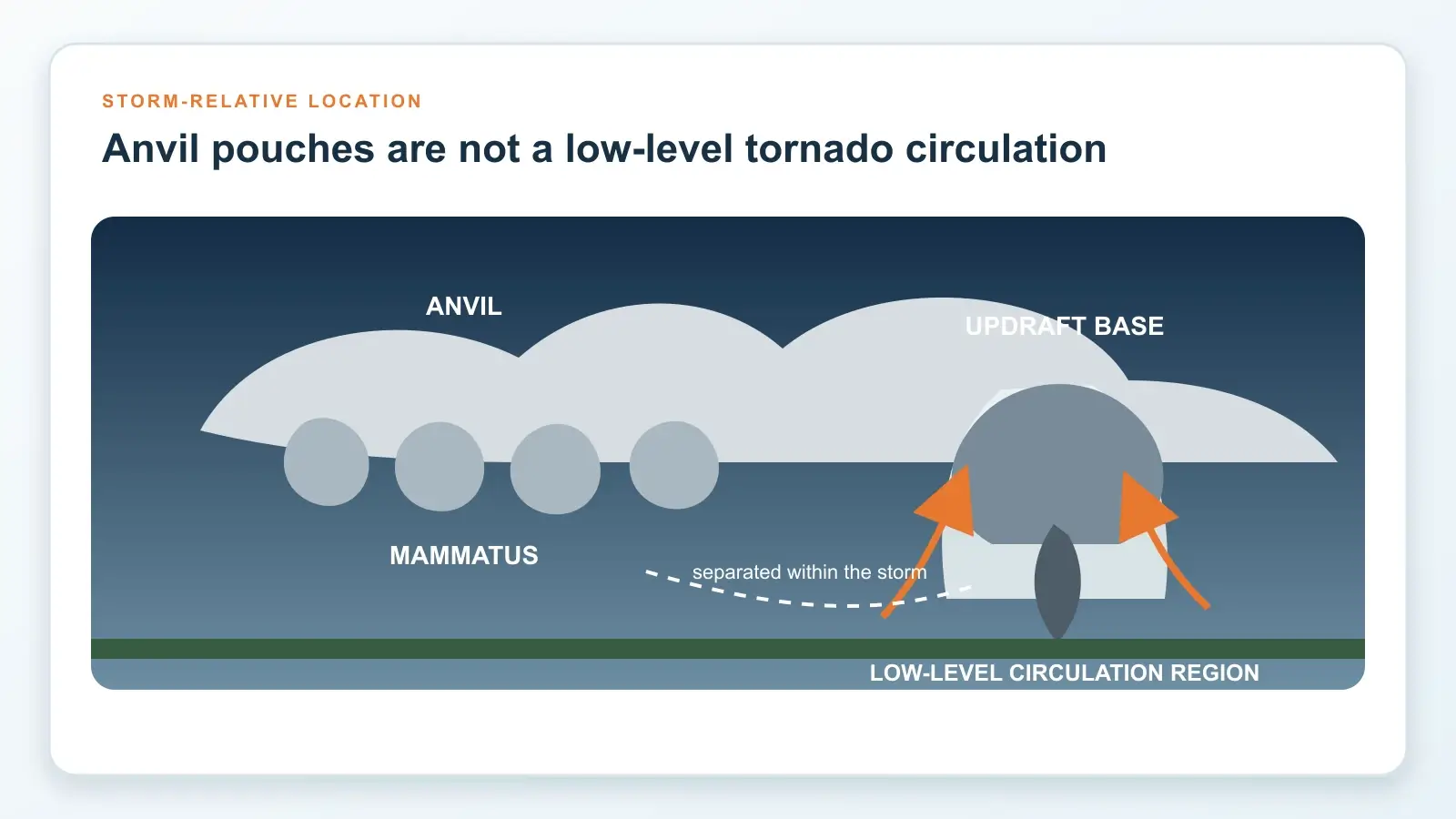
Which clues matter more for tornado risk
Start with the official warning polygon and your location. A tornado warning requires shelter whether or not mammatus, a funnel, or a wall cloud is visible. Radar velocity may reveal persistent rotation, and trained spotters may report a funnel or ground circulation. These data are interpreted together by National Weather Service forecasters.
At cloud base, a persistent rotating wall cloud beneath the storm updraft is more relevant than anvil mammatus. A condensation funnel with organized rotation is more direct evidence, and rotating dust or debris at the ground may show a tornado even when condensation does not connect all the way down. Our shelf cloud versus wall cloud guide places those features in the storm airflow.
Do not remain outside searching for visual confirmation. Rain-wrapped and nighttime tornadoes may be invisible. Mammatus can distract attention upward while damaging wind or lightning arrives from another part of the storm. Use a sturdy shelter and reliable alerts.
How to identify mammatus accurately
Look for multiple rounded lobes hanging from a shared cloud layer rather than one isolated lowering. Mammatus form a field on the underside, often with repeated pouch shapes and no organized extension toward the ground. They may change slowly compared with ragged scud racing beneath a low storm base.
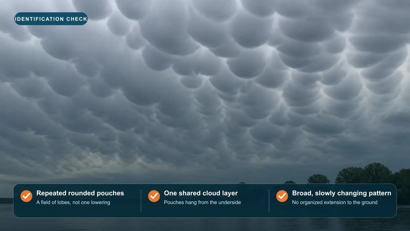
Do not confuse virga with pouches. Virga forms streaks of precipitation falling and evaporating below a cloud. Asperitas forms a chaotic wave-like underside rather than rounded lobes. A wall cloud is a localized lowering beneath an updraft base and is judged by position and rotation. A funnel is a rotating condensation feature extending from a convective base.
A wide landscape frame shows the relationship to the anvil and horizon better than a tight zoom. Photograph from shelter or after the lightning threat, and preserve time and direction. If thunder remains audible, follow the 30-minute lightning rule instead of walking into an open field for a picture.
How to turn a striking cloud into a useful observation
Record the time, location, direction, sky coverage, parent cloud, and whether precipitation or lightning is present. Note whether the storm is approaching, overhead, or receding based on radar and motion. A sequence of images every minute or two reveals growth and decay better than one processed photo.
Use restrained editing. Heavy contrast, sharpening, and saturation can make pouches look more turbulent or lower than they appeared. Preserve an unedited original and state when a photo is a panorama or time-lapse. Avoid captions that infer tornado development without supporting warnings or reports.
The accurate takeaway is nuanced but useful: mammatus are evidence of an interesting cloud boundary and often a deep thunderstorm anvil. They are not a standalone severe-weather forecast. Admire the structure, maintain lightning awareness, and let warnings and storm-scale evidence drive safety.
Frequently asked questions
Do mammatus clouds form before or after a storm?
They can appear before, during, or after the main storm at a location, but they are often most visible on the spreading or trailing anvil after the core has moved away.
Are mammatus clouds dangerous?
The pouches themselves are not a surface hazard. They may be associated with a thunderstorm that produces lightning, hail, wind, rain, or tornadoes elsewhere, so check the storm and warnings.
Can mammatus turn into funnel clouds?
The answer is no. Mammatus are lobes beneath a cloud layer, usually an anvil. A funnel is an organized rotating condensation feature beneath a convective updraft. They form through different processes.
Are mammatus rare?
They are less common than ordinary flat cloud bases but occur often enough around suitable anvils and other cloud layers. Dramatic lighting and large, well-defined pouches make the best examples memorable.
Sources and further reading
- World Meteorological Organization International Cloud Atlas: Mamma
- Journal of the Atmospheric Sciences: The Mysteries of Mammatus Clouds
- National Weather Service glossary: Mammatus
- National Weather Service Wilmington: SKYWARN spotter guide
- NASA Earth Matters: Mammatus clouds over Oklahoma
Fact-checked against WMO, National Weather Service, NASA, and peer-reviewed meteorological sources on August 30, 2026.