
Storm-spotting field guide
Shelf Cloud vs. Wall Cloud: The Inflow/Outflow Test
A shelf cloud marks thunderstorm outflow along a broad leading edge. A wall cloud forms in storm inflow beneath a localized rain-free base. Shape helps, but motion and position are the dependable tests.
Quick answer
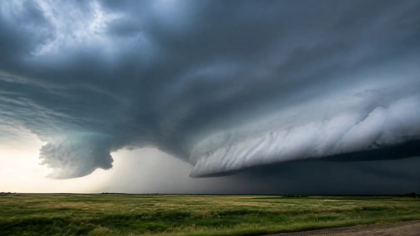
A shelf cloud is a long, low, horizontal cloud attached to the leading edge of a thunderstorm’s rain-cooled outflow. It usually arrives with wind spreading away from the storm. A wall cloud is a smaller, localized lowering beneath the storm’s rain-free updraft base, usually on the inflow side. Persistent organized rotation in a wall cloud raises tornado concern, but not every wall cloud rotates or produces a tornado.
Shelf clouds and wall clouds are confused because both can hang low beneath a dark thunderstorm. A still photograph makes the problem worse: it removes the motion of scud, the direction of the wind, and the feature’s position relative to precipitation. Those missing clues are more useful than how frightening the cloud looks.
The most reliable field question is not “Does it look like a wedge?” It is “Is this feature on the outflow edge or under the inflow updraft?” From a safe location, watch the feature and the larger storm for a minute or two. If a warning includes your location, shelter first and identify it later.
What a shelf cloud is
A shelf cloud is an accessory cloud attached to the base of a parent thunderstorm, most often along a gust front. Dense rain-cooled air spreads outward from the storm and lifts warm, moist air along its leading edge. Condensation forms a broad horizontal wedge or arc that can span much of the horizon. Its underside may look turbulent, ragged, layered, or greenish in unusual light.
Because it sits on outflow, a shelf cloud tends to move with the storm’s leading wind shift. Cool gusts, blowing dust, rapidly changing wind direction, and a temperature drop may arrive at or shortly after the cloud. The air motion is dominated by rising air along the front and spreading air behind it, not by one compact rotating updraft.
A shelf cloud is physically attached to the storm, even when rain or distance hides part of the connection. A detached horizontal tube that rolls about a horizontal axis is more accurately called a roll cloud. Both indicate a boundary, but the shelf remains connected to the storm base.
What a wall cloud is
A wall cloud is a localized lowering beneath a thunderstorm updraft, commonly under the rain-free base of a supercell. Moist inflow rises into lower pressure and cooler air beneath the updraft, allowing cloud to form below the surrounding base. Compared with a shelf cloud, it occupies a smaller part of the sky and is usually found on the storm’s inflow side rather than its advancing outflow edge.
Some wall clouds rotate, many do not. The feature becomes more concerning when rotation is persistent, organized, and increasing, especially when nearby inflow bands feed into it and the lowering remains attached to the same storm-scale updraft. Tornado development is possible beneath a rotating wall cloud, but the visual feature alone is not a tornado.
A wall cloud can be partly obscured by rain, and perspective can make a distant lowering look wider than it is. Do not drive closer to solve the identification problem. Use radar, official warnings, and an unobstructed view from a sturdy shelter.
Use the inflow/outflow test
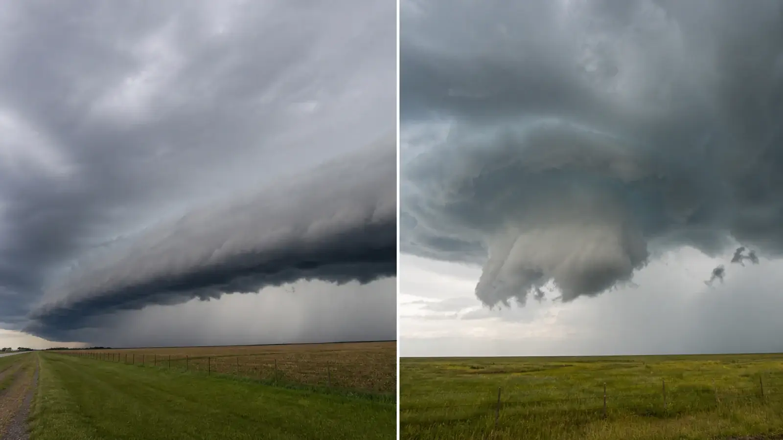
First locate the precipitation core and the storm’s direction of travel. A shelf cloud normally stretches along the leading edge, with rain and colder outflow behind it. A wall cloud normally sits beneath the updraft near a rain-free or lighter-precipitation base. The exact compass side varies with storm motion, so avoid memorizing “southwest side” as a universal rule.
Then watch nearby motion. Dust, leaves, and low cloud racing outward with a cool surge favor shelf-cloud outflow. Warm, humid wind feeding toward a localized lowering favors wall-cloud inflow. Ragged fragments may rise rapidly into either feature. This scud versus funnel cloud guide explains why rising scud is not automatically rotation.
Finally, look for organized rotation around a vertical axis. Shelf clouds can contain turbulent eddies and horizontal rolling motion, and brief gustnadoes can spin along a gust front. A wall cloud’s persistent vertical-axis rotation is the more meaningful tornado clue. If you cannot determine the axis or persistence, report the motion you see instead of forcing a label.
Rotation, rising motion, and misleading perspective
Fast motion is not the same as rotation. Scud can race sideways, surge upward, or change shape within seconds. A rotating wall cloud keeps identifiable fragments moving around a common center while the overall lowering persists. Watch fixed background references and avoid judging from a moving vehicle, where your own motion can create a false impression.
A shelf cloud seen end-on can resemble a compact lowering. A wall cloud viewed from far away can look like a shelf extending across the base. Wide-angle phone lenses exaggerate distance and curve straight horizons, while zoom compresses separate cloud layers. A short stabilized video with the horizon included is often more informative than one dramatic still.
Night makes visual identification especially unreliable. Lightning flashes reveal only brief, unevenly lit pieces of the base. Treat a suspicious lowering as a reason to monitor warnings, not as a reason to stand outside waiting for another flash.
Mammatus appear higher beneath an anvil as a broad field of rounded pouches rather than one low storm-base lowering. Our mammatus and tornado guide explains why the pouches do not predict a tornado.
What each cloud means for safety
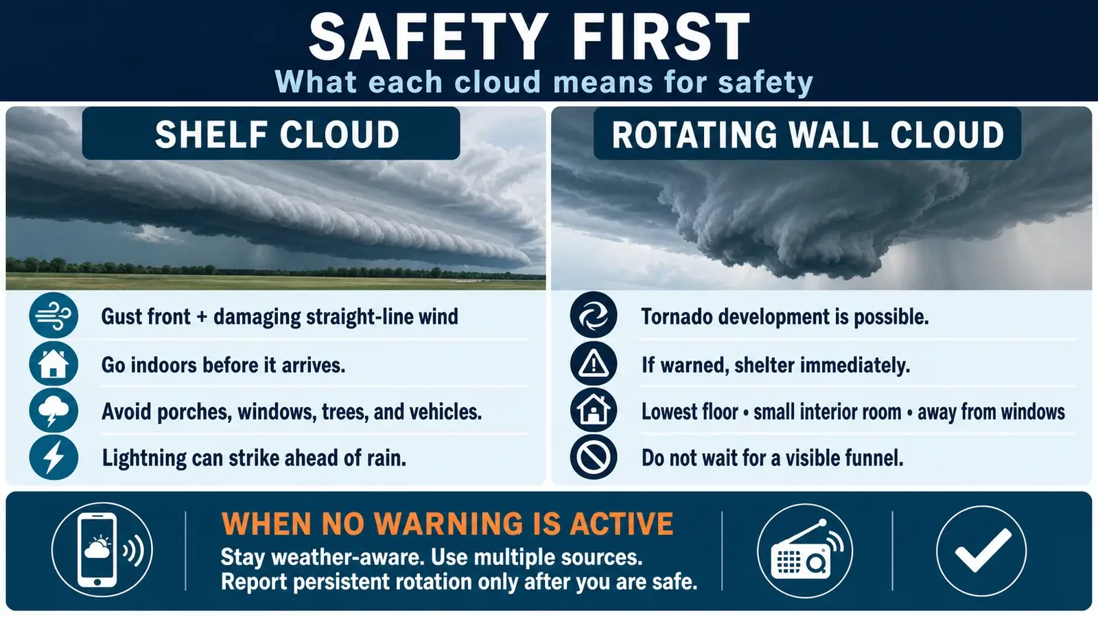
A shelf cloud means a gust front and potentially damaging wind are close. Move indoors before it reaches you. Do not stand on a porch to film it, and do not assume the absence of rotation makes the storm harmless. Severe straight-line wind can topple trees onto vehicles and buildings, and lightning may extend well ahead of the rain.
A rotating wall cloud indicates an organized updraft capable of tornado development. If a tornado warning includes your location, use your shelter plan immediately: lowest floor, small interior room, away from windows, with as many walls between you and outside as practical. Do not wait to see a funnel or debris because tornado circulation can reach the ground without a continuous visible condensation tube.
When no warning is active, remain weather-aware and use multiple sources. A trained report of persistent rotation can help forecasters, but shelter takes priority. The National Weather Service would rather receive an accurate description after you are safe than a confident label made from an exposed position.
How to make a useful report
Give the time and exact location, then describe the feature’s position and motion. Useful wording is “localized lowering beneath the rain-free base with persistent counterclockwise rotation for three minutes” or “long shelf cloud along the leading edge with strong cool wind spreading east.” State whether the report is direct observation, video review, or something relayed to you.
Avoid reporting “tornado” based only on a low cloud. Look for a condensation funnel with organized rotation or rotating dust and debris at the ground. If the base is hidden, say that. Photos or short video can help later, but never delay shelter or step into traffic for a clearer angle. Formal SKYWARN training provides local reporting criteria and many more moving examples.
The distinction is valuable because it connects a visible cloud to the airflow producing it. Shelf equals leading outflow boundary, wall equals localized inflow updraft lowering. That relationship remains useful even when the cloud shape is imperfect. The same airflow framework supports our microburst versus tornado guide, which combines damage patterns, radar, timing, and official surveys.
Frequently asked questions
Is a shelf cloud attached to the storm?
The answer is yes. A shelf cloud is attached to the parent thunderstorm along its gust front. Rain, haze, or perspective may hide part of the connection.
Does a shelf cloud rotate?
It may show turbulent or rolling motion, often around a horizontal axis. Persistent organized rotation around a vertical axis beneath a localized updraft is more characteristic of a rotating wall cloud.
Does every wall cloud produce a tornado?
The answer is no. Many wall clouds never rotate strongly or produce a tornado. Persistent and strengthening rotation makes the feature more concerning, but an official warning and ground evidence guide action.
Can a shelf cloud produce a tornado?
The shelf itself is an outflow feature, but a thunderstorm line can contain embedded tornadoes or brief gust-front vortices. Never use the shelf-cloud label as proof that tornado risk is zero.
Sources and further reading
- National Weather Service Louisville: Shelf cloud versus wall cloud
- National Weather Service Quad Cities: Spotter quick reference guide
- National Weather Service glossary: Gust front
- National Weather Service glossary: Wall cloud
Reviewed against current NOAA, National Weather Service, and other primary meteorological guidance on August 8, 2026.