
Severe-weather pattern guide
Derecho vs. Bow Echo vs. Squall Line: What Is the Difference?
A squall line describes storm organization, a bow echo describes radar shape, and a derecho describes a long-lived damaging-wind event. One storm can be all three, but the terms are not interchangeable.
Quick answer
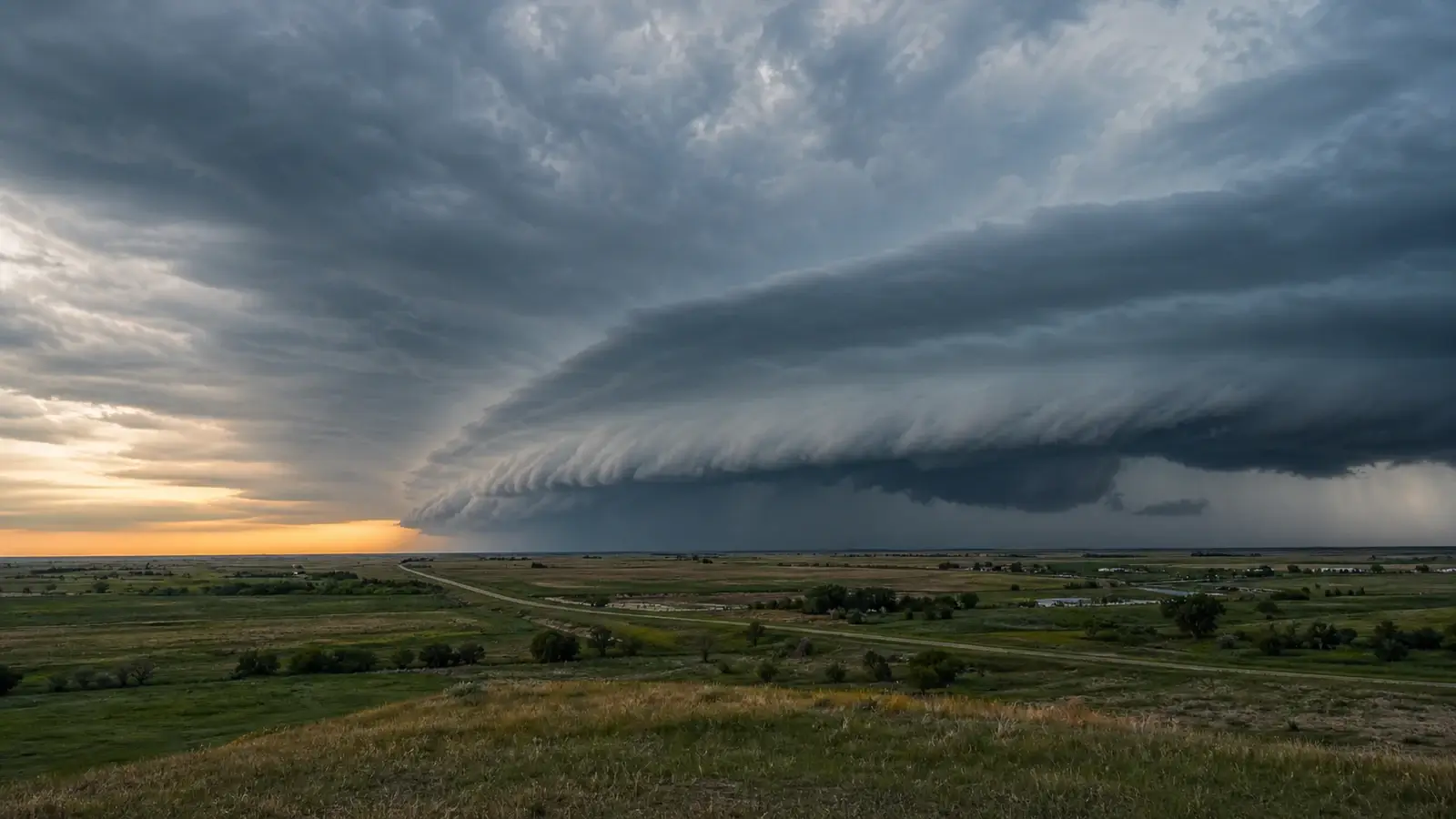
A squall line is a line of thunderstorms. A bow echo is a bowed-out radar reflectivity pattern, usually created when part of a storm line surges forward with strong outflow. A derecho is the widespread, long-lived damaging-wind event produced by an organized thunderstorm system. A derecho commonly contains one or more bow echoes and may look like a squall line, but many squall lines and bow echoes never produce a derecho.
These three terms often appear together after a major windstorm, which makes them sound like competing names for the same thing. They actually describe different levels of the event. Squall line tells you how thunderstorms are arranged. Bow echo tells you what a portion of that line looks like on radar. Derecho tells you what the storm system accomplished over a large area and a long path.
That distinction matters before, during, and after a storm. A forecaster can recognize a bowing line while it is happening, but a derecho classification depends on the evolving wind and damage swath. For a person in the path, the practical message is simpler: a severe thunderstorm warning for destructive straight-line wind deserves shelter even when no tornado is present.
Three terms that answer three different questions
A squall line is an elongated group of thunderstorms connected along a common line. Meteorologists also use the broader term quasi-linear convective system, or QLCS, because real storm lines can curve, break into segments, or contain gaps. The line may stretch tens or hundreds of miles, and its leading edge often carries heavy rain, lightning, abrupt wind shifts, and strong outflow.
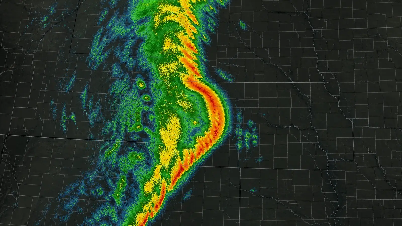
A bow echo is a radar signature. On reflectivity, part of a thunderstorm line bulges forward like an archer’s bow. The middle usually advances faster as a rear-inflow jet and repeated downbursts push air toward the ground and outward. Strong straight-line winds are favored near and just behind the apex, while small rotating circulations called bookend vortices can develop near the ends.
A derecho is the event-scale windstorm. NOAA educational guidance describes a derecho as a widespread, long-lived convective windstorm whose damage swath extends at least about 240 miles, with severe wind along much of the path. Researchers have proposed refinements to classification, so the responsible phrasing in real time is that a storm may produce a derecho rather than declaring one from a single radar frame.
How the three can overlap
Picture a long squall line moving east. One section begins to accelerate and bow outward. That section is now a bow echo within the larger line. If the organized system continues for many hours and produces a sufficiently long, coherent swath of damaging wind, the overall event may be classified as a derecho. In that example, all three terms are accurate, but each points to a different feature.
The reverse does not work. A 40-mile bow echo that produces scattered tree damage may be dangerous without meeting derecho scale. A squall line can remain nearly straight, weaken quickly, or produce mostly heavy rain. A derecho-producing system may contain several bowing segments rather than one perfect bow for its entire life. Radar appearance is evidence about storm structure, not a substitute for surface observations.
What to look for on radar
Start with a loop, not a screenshot. A developing bow echo becomes clearer when a central portion of the line repeatedly outruns adjacent sections. Reflectivity may show a sharp leading edge, a bowed arc, and sometimes a weaker-reflectivity notch entering from behind. Velocity can reveal strong outbound or inbound winds relative to the radar, but it measures only the component moving along the radar beam.
Location relative to the radar changes the color and clarity of the signature. A storm moving sideways across the beam can contain strong wind that radial velocity underrepresents. Farther from the radar, the beam samples progressively higher parts of the storm and may miss the lowest damaging flow. This is why meteorologists combine reflectivity, velocity, nearby radars, surface stations, spotter reports, and damage reports.
Do not use one hook, notch, or bright color as a label-maker. Bowing lines can also produce brief tornadoes, especially near small circulations embedded in the line. Conversely, a dramatic bow shape does not prove that damaging wind is reaching your location. Use the official warning and observed conditions rather than trying to diagnose safety from a consumer radar image alone.
Why bow echoes can produce destructive straight-line wind
Thunderstorm downdrafts bring air toward the surface. When that air hits the ground, it spreads outward, much like water from a faucet striking a sink. In an organized line, multiple downbursts can combine into a broad cold pool. A rear-inflow jet can descend into the back of the line and strengthen the forward surge, concentrating wind near the bow’s apex. Our microburst versus tornado guide takes a closer look at how one localized burst differs from tornadic rotation.
Straight-line does not mean weak or uniform. Derechos and intense bow echoes can topple mature trees, overturn high-profile vehicles, remove roofs, and interrupt power across many communities. Local burst swaths may be much stronger than surrounding wind, while terrain, tree health, building construction, and wind direction change the damage from one property to the next.
A survey may find mostly one-direction tree fall in a downburst, but real damage fields are messy. Trees deflect as they fall, structures channel wind, and embedded circulations can add convergence or rotation. One fallen tree is not enough to identify the cause because overlapping wind signatures require a broader damage survey.
What the warning will actually say
The National Weather Service does not issue a separate derecho warning. People in the path receive severe thunderstorm warnings, and sometimes tornado warnings for embedded circulations. A destructive damage-threat tag may trigger a Wireless Emergency Alert when exceptionally strong thunderstorm winds are expected. The word derecho may appear in forecasts, discussions, or public statements, but the severe thunderstorm warning is the message that tells you to act.
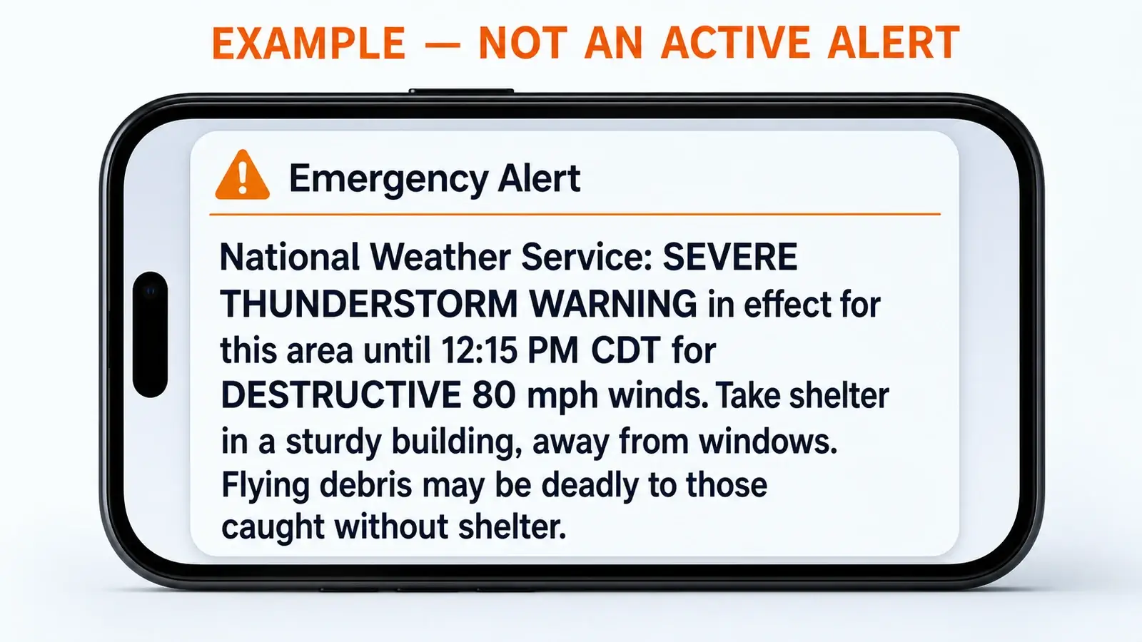
Move into a sturdy building, away from windows, and use an interior room on the lowest practical floor when destructive wind is approaching. Avoid large unsupported roofs. Vehicles, manufactured homes, tents, and boats are especially vulnerable. Charge devices before the line arrives, secure outdoor objects only while conditions are still safe, and plan for blocked roads and power failures after it passes.
Do not step outside when the first gust ends. A line can contain multiple surges, lightning can continue behind the leading edge, and damaged trees or power lines may fall later. Follow the same thunder safety timing described in our 30-minute lightning rule before resuming exposed activity.
Common misconceptions
“Every bow echo is a derecho” is false because bow echo describes shape, not path length or the continuity of damaging wind. “A derecho is a land hurricane” is also misleading. The nickname conveys broad wind damage, but a derecho is produced by thunderstorms and downbursts, not by the warm-core circulation and ocean energy source of a tropical cyclone.
“Straight-line winds only blow in one perfectly straight direction” oversimplifies the term. It mainly distinguishes non-tornadic thunderstorm wind from a tornado. Downbursts spread outward, bow echoes contain vortices, and wind direction can change along the line. Finally, a green or red velocity patch is not automatically a measured surface gust. It is radar-sampled motion aloft along one viewing direction.
The most useful mental model is a hierarchy: line is organization, bow is shape, derecho is impact across time and distance. That keeps the vocabulary accurate without minimizing the danger of a severe bow echo that ultimately falls short of derecho classification.
Frequently asked questions
Is every bow echo a derecho?
The answer is no. A bow echo is a radar shape that can last a short time or cover a limited area. A derecho requires a widespread, long-lived damaging-wind swath produced by an organized thunderstorm system.
Can a squall line produce tornadoes?
The answer is yes. Small circulations embedded in a line can produce brief tornadoes, especially near bows, kinks, and line-end vortices. Follow a tornado warning even when the storm looks primarily linear.
Can meteorologists call a derecho before it ends?
They can identify an environment and storm evolution favorable for a derecho and may use that wording operationally, but final classification depends on the complete wind and damage path.
Which part of a bow echo is most dangerous?
The bow apex often carries intense straight-line wind, while the ends and small kinks can contain rotation. Any location inside the warning polygon should prepare for damaging wind rather than relying on one favored spot.
Sources and further reading
- NOAA NESDIS: What is a derecho?
- National Weather Service Indianapolis: Wind and warning definitions
- National Weather Service Louisville: Squall lines and bow echoes
- National Weather Service: Thunderstorm hazards and safety
Reviewed against current NOAA, National Weather Service, and other primary meteorological guidance on August 8, 2026.